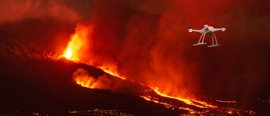
Drones are proving to be increasingly helpful. As commented in other articles, one of these uses is the scientific one, which is becoming more than evident in situations such as those being experienced in the volcano of La Palma.
Drones are the ‘’eyes of the scientists’’ due to the variety of tasks they are carrying out in this natural phenomenon; some of these tasks are:
- Creation of 3D models of the terrain using geospatial software for long-term monitoring.
- Thermal data collection allows researchers to obtain data such as the magma coming out, its temperature, speed, and hottest zones.
- CO2 data collection to predict its release level and possible upcoming activity, as well as other gases.
- Surface and volume measurements of the material from the lava flow by capturing and collecting images before and after the eruption.
- Monitoring of the lava pathway.
- Safe surveillance and control.
A special issue to comment on is the involvement of different professionals in this kind of operation. These activities are also closely followed by geologists. These scientists represent an added value to drones because they are analyzing and understanding what is seen through the cameras.
Moreover, drones are very resistant to high temperatures (between 500 and 1000ºC) and to ash, which affects the stability and also the safety & security of the intended operation.
Many drones are flying over La Palma these days; however, the four scientific drones have priority over the rest. These aircrafts are controlled by the Instituto Geológico y Minero de España (IGME) and the Emergencies and Rescue Group of the Canarias Government (GES). The information coming from them is managed by the PEVOLCA Scientific Committee, which also contains this emergency. Sometimes, this Committee assesses the knowledge in real-time.
Legally, these aircraft can fly up to 120 meters of the ceiling and at a maximum of 500 meters from the pilot. But in the La Palma emergency, conditions are different because they can fly higher, up to 500 meters from the sea level and up to 4 kilometers away from the take-off point.
The volcano’s behavior is changing every day, which means that these drones still have a long list of tasks to do, hopefully in a successful way.
Sources:
- https://www.niusdiario.es/ciencia-y-tecnologia/ciencia/dentro-boca-crater-asi-trabajan-drones-cientificos-volcan-palma-igme-ges_18_3211172984.html
- https://diariodeavisos.elespanol.com/2021/10/los-drones-en-el-volcan-de-la-palma/